• About
  • Work
  • Maps
  • Writing
  • Strange Borders
Menu

am proehl

  • About
  • Work
  • Maps
  • Writing
  • Strange Borders
Croatia-Serbia, Liberland Map.png

The Strange Border between Croatia and Serbia in Liberland

June 24, 2018

Historically speaking, rivers make great borders. After oceans, few natural features are better at defining “us" and “them" than rivers. Rivers could be dangerous and hard to cross. They made great reference points for treaties. There’s just one problem with all of this. Rivers change course faster than treaties do. Such is the case with the path of the Danube as it winds its way between what is now Croatia and Serbia.

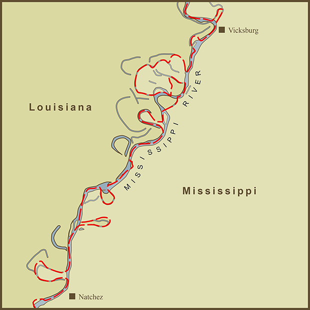
I’ve written about this issue before. The Mississippi river defines and divides multiple states as it runs it course from Minnesota to Louisiana. State borders have stayed fixed as the river has changed course dramatically. What makes this example unique is the nature of the claims to this stretch of land by Serbia, Croatia and a certain libertarian-minded man named, Vit Jedlicka.

The Danube had been the accepted border between the two regions that would be come Croatia and Serbia. As a border, it was great but as a navigable river for transport, not so much. So the river was straightened and, as a recent article in the New York Times put it, "The straightened Danube was a vast improvement for international riverine transport, but in the process, four large uncontiguous bulges of Croatia became stranded alone on the Serbian side, and one small pocket of Serbia, on what was now the far bank, became attached to the Croatian mass."

The obvious imbalance of territory is what makes the story so interesting. The four large bulges are of obvious interest to Serbia. They are now on Serbia’s side of the river. Accordingly, they have staked their claim to them. The natural response would be for Croatia to claim the formerly Serbian land on their side of the river as their own. But to do so would also legitimize what Serbia did and the result would be massive land gain for Serbia. So Croatia has taken the tactic that the historic border should remain intact. Their claim has the side effect that neither country claims the small area of land on the Coratian-side of the river. This puts the parcel in question into a situation known as "terra nulls”. Land that remains unclaimed by any state. Except now there is a new twist.

Nature and men both seem to abhor a vacuum. Upon learning about the unclaimed land, Vit Jedlicka, a Czech politician with statehood aspirations, decided to pounce. The man and his plan make for a great story that is better told by the New York Times.

Sources: Wikipedia , NY Times 

Tags snaking-rivers
1 Comment
Louisiana-Mississippi, River Border Map.png

A Map of the Louisiana / Mississippi State Border along the Mississippi River

June 24, 2018

I stumbled on this stretch of the Mississippi River while I was working on the Mississippi River TypeMap. I noticed that the state border was meandering as much as the river itself but not always in sync with it. As is common with many rivers, the river has changed course since the the state borders were set.

I wonder what it is like for those living along the river in these spots. The Mississippi is such a prominent and natural boundary that most residents must regard it as their state border. In "The Omnivore's Dilemma", Michael Palin interviews a mushroom forager about the mysteries of how mushrooms grow. The forager summarized the mystery as, "why here and not there and why now and not then?". I was reminded on this quote while I was making the map. There are multiple remnants of the river's past course... why weren't they used to mark the border. The answer is that the borders as marked followed the centerline of the Mississippi River at the time that the state borders were drawn.

Given that the river is such a strong boundary, it would seem natural to have the border remain in the center of the river even as the river changes course. But that is not in the nature of how borders are drawn. Ink is clearly more permanent than water.

Sources: Wikipedia

Tags snaking-rivers
Comment
Brazil-Uruguay, Brazilian Island Map.png

"Betweenity" - A Map of the Brazil / Uruguay Border Dispute over Brazilian Island

June 24, 2018

It's strange that the island being disputed is called, Brazilian Island as the name makes it sound like there's no dispute at all. Information on the roots of the dispute are scarce. The island is at the confluence of the Quarai, Cuareim, and Invernada rivers. The rivers form a tripoint border with Argentina but the Argentinian border is not under dispute.

In an essay titled, "Islands in Between", Godfrey Baldacchino offers the following observation, "We should not be surprised: borders, in spite of conventional wisdom and official intent, are often porous, permeable features: they are liminal spaces with osmotic properties, important tools in a contemporary game of economic prosperity, military strategy or national security. Even here, islands ‘in between’can play a key role."

The same article quotes the Former Prime Minister of Trinidad and Tobago as saying that his country operates in a state of "betweenity" having been claimed by more than one nation. I like that word. It would have been a good way to describe my career on more than one occasion.

Tags snaking-rivers, disputed
Comment
Kentucky-Missouri, New Madrid Bend Map.png

A Map of the Strange Kentucky Border at the New Madrid Bend in the Mississippi River

June 24, 2018

The border of Kentucky at what is known as "The New Madrid Bend" owes it's strangeness to the serpentine path of the Mississippi River. The River was supposed to define the western edge of the state of Kentucky and the Southern edge of Missouri. The result is an exclave peninsula of land in Kentucky that is completely surrounded by Missouri and Tennessee. To drive here from the rest of Kentucky, you must leave the state, drive through Tennessee and come back into Kentucky.

This spot along the Mississippi River is also the site of several historic events. Most notable is the "Battle of Island Ten" in the Civil War where Confederate Troops occupied Island Ten (now mostly part of the shoreline at the southern-most part of the bend in the map). The plan was to block and defeat the Union Troops coming down the Mississippi from the North at a slow point in the river. The plan didn't work so well. Although this was a potentially vulnerable spot in the river, Island Ten was also remote and could only be re-supplied by a single road through swamp and marsh land (the Union eventually succeeded in cutting off Confederate supply lines).

Mark Twain wrote about the area in his book, "Life on the Mississippi" and in particular about the feud between the Darnell and Watson families. One family was from Kentucky, the other from Tennessee. According to Twain, the two families attended the same church at what is/was known as Compromise Landing. The Church straddled the border between Kentucky and Tennessee enabling the families to walk up the aisle on their side of the church and attend services without stepping into the other state.

Lastly, New Madrid was the epicenter for several of the strongest Earthquakes ever felt in the United States in 1811 and 1812. According to Wikipedia, the earthquakes were so disruptive that they reportedly reversed the course of the Mississippi River around the area.

Sources: Wikipedia

Tags snaking-rivers
Comment

A Map of Gambia's Border as Defined by the Gambia River

June 24, 2018

You can call it, Gambia but the real name is, "The Gambia"... a bit of attitude from the smallest country in continental Africa. The country's entire border is defined by its namesake river and, were it not for its outlet to the Atlantic would be surrounded by Senegal. Rivers are used to mark borders all over the World but usually the river IS the border. Gambia is unique in that the river and its banks essentially define the country rather than the border.

Like too many countries in Africa, The Gambia owes its strange borders to its colonial-era overlords which included Portugal, Great Britain and France at various times. The country follows the path of the Gambia River with borders falling between 10 and 15 miles north and south of the river banks. The river and region have unfortunate close ties to the Atlantic Slave Trade. The Gambia River was navigable by tall ships far into the interior of the African continent enabling a disproportionate number of slaves to have left Africa by this route. Though the active slave trade had long-since ended, Gambia only officially abolished slavery in 1906.

Sources: Wikipedia

Tags snaking-rivers
1 Comment
Iowa-Nebraska, Carter Lake Map.png

A Map of the Border Between Nebraska and Iowa at Carter Lake

June 24, 2018

Poor little Carter Lake. It reminds me of the phrase, "a mystery wrapped inside an enigma" from the Oliver Stone film, 'JFK'. Carter Lake is a town in Iowa surrounded by a namesake oxbow lake that it doesn't own, then Nebraska, and finally, the sweeping curve of the Missouri River. It is the only town in Iowa that lies west of the Missouri River. According to Wikipedia, there was a flood in 1877 that redirected the course of the Missouri which left Carter Lake on the wrong side from that point on.

There are a number of strange borders in the US that are the result of river courses. When the initial borders were being drawn up, care was taken to not orphan small areas on the far side of a river that would make the area hard to govern. Bridges across major rivers were rare in those days and the natural boundaries of the rivers mattered. But rivers are dynamic and their courses are always changing particularly in flat, easily flooded land. I have already documented two other examples where this has happened, The "New Madrid Bend" border between Kentucky and Missouri and the winding border between the Louisiana and Mississippi along the Mississippi River near Vicksburg. If I was asked, I would suggest that a river border should stay a river border even if the river changes course. It seems like the natural recommendation. History has judged me wrong. Once a border has been staked out, human forces will act to keep it unchanged even as the underlying river seeks a new course. Since this land is often prone to flooding it is not usually prime real estate. Rarer still is the case of Carter Lake where a whole town occupies that changing landscape.

Omaha Nebraska lies just West of the map I've drawn. If you fly to Omaha, you land at Eppley Airfield. The strange border around Carter Lake creates a situation where, after landing in Nebraska, one must drive through Iowa to get back to Nebraska and the city of Omaha. As out-of-towners are often confused about directions, it must by particularly confusing to see the otherwise friendly signs in Carter Lake announcing, "Welcome to Iowa".

Sources: Wikipedia

Tags snaking-rivers
1 Comment

Latest Posts

Featured
Mar 22, 2020
A Map of the 'Southwick Jog' between Massachusetts and Connecticut
Mar 22, 2020
Mar 22, 2020
Jun 24, 2018
The Property Border in Seattle that was Forced to go Around Edith Macefield’s House
Jun 24, 2018
Jun 24, 2018
Jun 24, 2018
The strange, slavery-defined border of Oklahoma’s Panhandle
Jun 24, 2018
Jun 24, 2018
Jun 24, 2018
Entrepreneurial Strangeness, A Map of the French-Swiss Border at the Hotel Arbez
Jun 24, 2018
Jun 24, 2018
Jun 24, 2018
The Strange Border between Croatia and Serbia in Liberland
Jun 24, 2018
Jun 24, 2018
Jun 24, 2018
A Map of the Bir Tawil "Triangle" and Related Territory Dispute Between Egypt and the Sudan
Jun 24, 2018
Jun 24, 2018
Jun 24, 2018
A Map of the Louisiana / Mississippi State Border along the Mississippi River
Jun 24, 2018
Jun 24, 2018
Jun 24, 2018
A Map of the USA / Russia Border as it Passes Between the Diomede Islands
Jun 24, 2018
Jun 24, 2018
Jun 24, 2018
A Map of the Uganda / Kenya Border Dispute Over Migingo Island
Jun 24, 2018
Jun 24, 2018
Jun 24, 2018
A Map of the Slovenia / Croatia Border as it Passes Through the Middle of Restaurant Kalin in the Town of Bregana
Jun 24, 2018
Jun 24, 2018

All maps are copyright 2018 by Andy Proehl