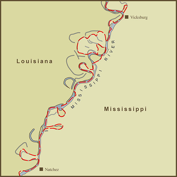
I stumbled on this stretch of the Mississippi River while I was working on the Mississippi River TypeMap. I noticed that the state border was meandering as much as the river itself but not always in sync with it. As is common with many rivers, the river has changed course since the the state borders were set.
I wonder what it is like for those living along the river in these spots. The Mississippi is such a prominent and natural boundary that most residents must regard it as their state border. In "The Omnivore's Dilemma", Michael Palin interviews a mushroom forager about the mysteries of how mushrooms grow. The forager summarized the mystery as, "why here and not there and why now and not then?". I was reminded on this quote while I was making the map. There are multiple remnants of the river's past course... why weren't they used to mark the border. The answer is that the borders as marked followed the centerline of the Mississippi River at the time that the state borders were drawn.
Given that the river is such a strong boundary, it would seem natural to have the border remain in the center of the river even as the river changes course. But that is not in the nature of how borders are drawn. Ink is clearly more permanent than water.
Sources: Wikipedia

