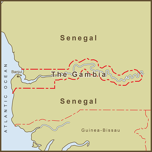
A Map of Gambia's Border as Defined by the Gambia River
The Gambia
You can call it, Gambia but the real name is, "The Gambia"... a bit of attitude from the smallest country in continental Africa. The country's entire border is defined by its namesake river and, were it not for its outlet to the Atlantic would be surrounded by Senegal. Rivers are used to mark borders all over the World but usually the river IS the border. Gambia is unique in that the river and its banks essentially define the country rather than the border.
Like too many countries in Africa, The Gambia owes its strange borders to its colonial-era overlords which included Portugal, Great Britain and France at various times. The country follows the path of the Gambia River with borders falling between 10 and 15 miles north and south of the river banks. The river and region have unfortunate close ties to the Atlantic Slave Trade. The Gambia River was navigable by tall ships far into the interior of the African continent enabling a disproportionate number of slaves to have left Africa by this route. Though the active slave trade had long-since ended, Gambia only officially abolished slavery in 1906.
Sources: Wikipedia