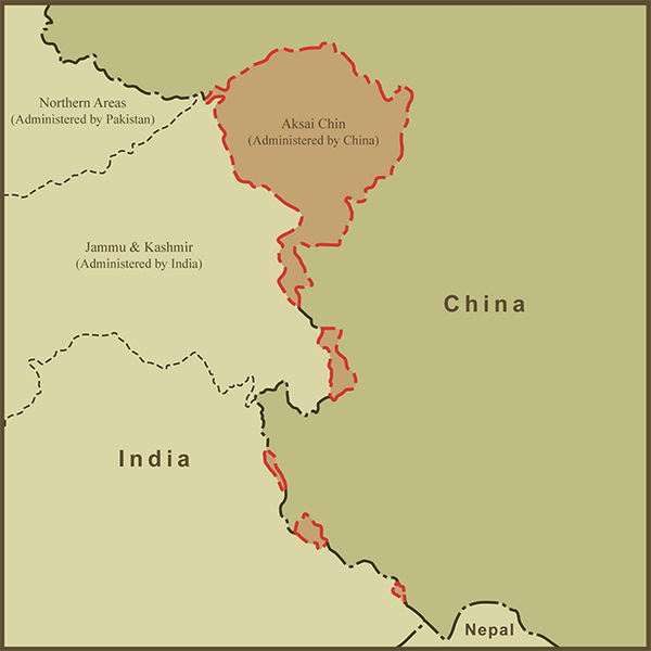
A Map of Aksai Chin and the Border Dispute Between China and India
Aksai Chin is a high-altitude desert, virtually uninhabited, and has few natural resources and yet it remains one of two long-standing border disputes between China and India... the other being Arunachal Pradesh (see my other map covering this dispute). China remains in control of Aksai Chin while India controls Arunachal Pradesh.
In 1954, India noticed that China had built "Chinese National Highway 219" through Aksai Chin and was now claiming the region as its own. Indian Maps prior to 1954 had been quite vague about borders and territory in this region. Never the less, concerns over the road and newly-claimed territory were a key factor leading up the 1962 Sino-Indian War.
Ironically, although the dispute is between India and China, the source of the dispute has more to do with relations between Russia and Britain. The earliest maps detailing various proposed borders date from around 1865 and relate to a strategy by the British to establish defensible border states between its colonial pursuits and Russia's interests in expanding to the South. It later became known that China was showing interest in the area and the British felt that having an ally like China in the area was preferable to Russia.
According to the maps I've used as reference, the dispute is actually five separate disputes... five border disputes for the price of one!

